Caribbean geology

Moderators: Elvis, DrVolin, Jeff

Re: Caribbean geology

Postby chiggerbit » Sun Jan 17, 2010 6:35 pm

Also, what I'm wondering is if the Farallon Plate is actually moving, or is it only giving the appearance of moving due to the North American Plate, which sits on top of it, doing the moving. In other words, are both the Farallon and the Caribbean plates stationary?
chiggerbit
 
Posts: 8594
Joined: Tue May 10, 2005 12:23 pm
Blog: View Blog (0)

Re: Caribbean geology

Postby chiggerbit » Sun Jan 17, 2010 7:20 pm

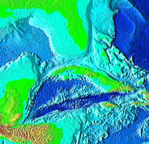
More on the ancient, mostly-subducted Farallon Plate:

http://www.livescience.com/environment/ ... quake.html

Source of Major Quakes Discovered Beneath U.S. Heartland

By Robin Lloyd, LiveScience Senior Editor

posted: 02 May 2007 ET


Scientists have finally figured out what might have caused a series of devastating earthquakes that struck the Midwest nearly 200 years ago at a set of faults that has confused geologists for a long time.

And the results suggest the region, still seismically active today, is going to keep shaking for a long time, and another big one will hit on the same 500-year cycle that has rocked the Heartland for as far back as records, legends and memory serve.

The largest of three or four big seismic events that stretched from December 1811 to February 1812 is called the New Madrid Earthquake and had an estimated 8.0 magnitude, strong enough to cause the nearby Mississippi River to temporarily flow backward. Its epicenter was in the town of New Madrid in southeast Missouri, near the Kentucky and Tennessee state lines. Hundreds of aftershocks followed for several years.

The damage from the New Madrid quake was bad enough in the early 19th century—half of the town was destroyed, but with many more people and buildings now in the area, a similar event in the region today would be devastating, seismologists and engineers agree.

More to come

The seismic zone today generates about 200 tiny quakes annually, but it also let loose a magnitude 4.1 quake in February 2005 and a magnitude 4.0 quake in June 2005. An estimate from the 1980s asserted a 9-in-10 chance of a magnitude 6 or 7 temblor occurring in this area within the next 50 years. Later estimates have reduced this probability somewhat, though there is no consensus among researchers.

These mid-continent temblors have long fascinated seismologists because of the mysterious origin of earthquakes that occur not at the edges but in the center of tectonic plates such as the North American Plate that underlies the continent.

One team of seismologists had thought that high density pillow lavas in the lower crust beneath the New Madrid region could have pulled the crust downward and thereby generated surface stresses that triggered the quakes.

Now, Allessandro Forte of the Université du Québec à Montréal and his colleagues have arrived at a more dramatic mechanism—an ancient, giant slab of Earth called the Farallon slab that started its descent under the West Coast 70 million years ago and now is causing mayhem and deep mantle flow 360 miles beneath the Mississippi Valley where it effectively pulls the crust down an entire kilometer (.62 miles).


"This remarkable localization of flow in the mantle below New Madrid, originating so deep below the surface, was completely unrecognized prior to our work," Forte told LiveScience.

Slabs like this that sink oceanic crust are called subduction zones, and those adjacent to Japan produce intense and damaging seismic activity.

"We have discovered an analogous subduction zone, deep inside the Earth below the central Mississippi River Valley," Forte said.

Forte and his colleagues at the University of Toronto and the University of Texas based their findings on high-resolution seismic tomography images that were used to predict the topography and viscous flow of the mantle under and around North America. They used the model to focus on the New Madrid seismic zone and propose that the descending slab and associated mantle flow directly below the New Madrid seismic zone strains the overlying crust, causing seismic ruptures.

The results were published in a recent issue of Geophysical Research Letters.

Still diving

The Farallon plate will continue to descend into the deep mantle and thus to cause mantle downwelling in the New Madrid region for a long time.

"[This] suggests that the seismic risk in the New Madrid region will not fade with time," Forte said.

The fault structure under the New Madrid region is a "failed rift" created by the opening of the ocean that later became the Atlantic Ocean 650 to 600 million years ago, Forte said.

That activity also caused rifts in the St. Lawrence, Saguenay and Ottawa river valleys in Canada, where there is similar mid-continental quaking, he said. Another set of faults far from the boundaries of the North American Plate are associated with the Keweenawan Rift, a 1240-mile-long rift in the area surrounding Lake Superior.
Last edited by chiggerbit on Sun Jan 17, 2010 7:29 pm, edited 2 times in total.
chiggerbit
 
Posts: 8594
Joined: Tue May 10, 2005 12:23 pm
Blog: View Blog (0)

Re: Caribbean geology

Postby chiggerbit » Sun Jan 17, 2010 7:23 pm

Another reason I'm looking at whether there's a Caribbean Plate connection to the ancient Farallon Plate is that weird Nebraska earthquake that freemason mentioned a few weeks ago.
chiggerbit
 
Posts: 8594
Joined: Tue May 10, 2005 12:23 pm
Blog: View Blog (0)

Re: Caribbean geology

Postby chiggerbit » Wed Jan 20, 2010 2:34 pm

Check this out, there has been another earthquake "aftershock" in Haiti today, one in the Cayman Islands yesterday of 5.8, and now a 6.5 one on the Mexico/Guatemala border. It sure looks like a line following that Cayman Trench:

Image

(Click to enlarge.)

http://rawstory.com/news/afp/_6_5_level ... 02010.html

'6.5 level quake' shakes Mexico-Guatemala border
Published: Wednesday January 20, 2010


An earthquake measuring 6.5 on the Richter scale shook the border of Guatemala and Mexico, seismologists in Nicaragua said Wednesday, saying that there was no immediate word of damage or injuries.
chiggerbit
 
Posts: 8594
Joined: Tue May 10, 2005 12:23 pm
Blog: View Blog (0)

Re: Caribbean geology

Postby chiggerbit » Wed Jan 20, 2010 2:56 pm

Wiki on the Cayman Trench:

http://en.wikipedia.org/wiki/Cayman_Trough

Image

Cayman Trough
From Wikipedia, the free encyclopedia

Coordinates: 18°30′N 83°0′W

Satellite image of the Cayman Trough.

The Cayman Trough, or Cayman Trench, also called Bartlett Deep, or Bartlett Trough, is a complex transform fault zone pull apart basin which contains a small spreading ridge on the floor of the western Caribbean Sea between Jamaica and the Cayman Islands.[1] It forms part of the tectonic boundary between the North American Plate and the Caribbean Plate. It extends from the Windward Passage, going south of the Sierra Maestra Cuba toward Guatemala. The transform continues onshore as the Motagua Fault which cuts across Guatemala and back offshore under the Pacific Ocean where it intersects the Middle America Trench subduction zone. The relatively narrow trough trends east-northeast to west-southwest and has a maximum depth of 7,686 meters (25,216 ft); it is the deepest point in the Caribbean Sea. Within the trough is a slowly spreading north-south ridge which may be the result of an offset or gap of approximately 420 kilometers (260 mi) along the main fault trace.

During the Eocene the trough was the site of a subduction zone which formed the volcanic arc of the Cayman Ridge and the Sierra Maestra volcanic terrain of Cuba to the north as the northeastward moving Caribbean Plate was subducted beneath the southwest-moving North American Plate, or as some researchers contend, beneath a plate fragment dubbed the East Cuban Microplate.[2]

As of 2008 the Cayman Trough has not been explored; a UK team from the National Oceanography Centre in Southampton (NOCS) equipped with an autonomously controlled, robot submarine, are set to begin mapping the full extent of the trench and finding the volcanic vents on the ocean floor.[3]
Last edited by chiggerbit on Wed Jan 20, 2010 3:11 pm, edited 1 time in total.
chiggerbit
 
Posts: 8594
Joined: Tue May 10, 2005 12:23 pm
Blog: View Blog (0)

Re: Caribbean geology

Postby chiggerbit » Wed Jan 20, 2010 3:05 pm

The Caribbean Plate is moving to the east while the North American Plate is moving to the west.


...as the northeastward moving Caribbean Plate was subducted beneath the southwest-moving North American Plate


This plate [Caribbean Plate] remains at a fixed spot relative
to the deep Earth, while the North American
plate, which includes the continent of
North America and the western North
Atlantic ocean basin, is being shoved
westward.


??????????
chiggerbit
 
Posts: 8594
Joined: Tue May 10, 2005 12:23 pm
Blog: View Blog (0)

Re: Caribbean geology

Postby chiggerbit » Wed Jan 20, 2010 3:37 pm

Yikes, the Dominican Republic, which shares the same island as Haiti, had an 8.1 earthquake in 1946, and there was an 8.1. in the Puerto Rico Trench in 1787.
chiggerbit
 
Posts: 8594
Joined: Tue May 10, 2005 12:23 pm
Blog: View Blog (0)

Re: Caribbean geology

Postby chiggerbit » Wed Jan 20, 2010 3:44 pm

Image

Tectonic and seismic map of Puerto Rico Trench area. Arrows show direction of plate movements. USGS.
chiggerbit
 
Posts: 8594
Joined: Tue May 10, 2005 12:23 pm
Blog: View Blog (0)

Re: Caribbean geology

Postby chiggerbit » Wed Jan 20, 2010 4:08 pm

Hmmm, wonder if there's any connection.

Image
This photo is a sinkhole that occurred early this year in Guatemala . The hole swallowed a dozen homes and killed at least 3 people
chiggerbit
 
Posts: 8594
Joined: Tue May 10, 2005 12:23 pm
Blog: View Blog (0)

Re: Caribbean geology

Postby 82_28 » Fri Jan 22, 2010 12:06 am

Cocos and Farallon. Hmmm.

Image

Image

"Jay Leno says it's not his fault, and other moments from late-night TV" --Random Headline floating around out there
There is no me. There is no you. There is all. There is no you. There is no me. And that is all. A profound acceptance of an enormous pageantry. A haunting certainty that the unifying principle of this universe is love. -- Propagandhi
User avatar
82_28
 
Posts: 11194
Joined: Fri Nov 30, 2007 4:34 am
Location: North of Queen Anne
Blog: View Blog (0)

Re: Caribbean geology

Postby chiggerbit » Fri Jan 22, 2010 2:12 pm

The stresses are holding part
of the North American plate down to
form the trench.


So the little Caribbean Plate, in effect, is holding down the great big North American Plate? Hmmmm. Is the North American Plate being held down or is the more-northern part of it being pushed up from underneath by the ancient Farallon Plate, tipping the southern border downward?
chiggerbit
 
Posts: 8594
Joined: Tue May 10, 2005 12:23 pm
Blog: View Blog (0)

Re: Caribbean geology

Postby chiggerbit » Fri Jan 22, 2010 6:57 pm

http://everything2.com/index.pl?node_id=1370785

.... Finally, around 23 million years ago, the remnant of the Farallon Plate split into the Cocos Plate subducting beneath Central America and the Nazca Plate subducting beneath South America.

Even buried beneath North America, the Farallon Plate is still not dead. Seismologists are able to model1 the disintegrating remnants of the plate several hundreds of kilometers beneath the crust, with the furthermost corner under the Gulf of St. Lawrence.
chiggerbit
 
Posts: 8594
Joined: Tue May 10, 2005 12:23 pm
Blog: View Blog (0)

Re: Caribbean geology

Postby chiggerbit » Sat Jan 23, 2010 3:23 pm

Stong earthquakes in Bolivia and on the Costa Rica border. Maybe not exactly "Caribbean", but to do with the relationship of other nearby plates to the Caribbean one.

http://www.earthtimes.org/articles/show ... uakes.html
chiggerbit
 
Posts: 8594
Joined: Tue May 10, 2005 12:23 pm
Blog: View Blog (0)

Re: Caribbean geology

Postby chiggerbit » Tue Jan 26, 2010 6:01 pm

Aha, I've been wondering if the Caribbean Plate met the Cocos Plate, and if not, what was in between. It appears in part to be the little Panama Plate:

http://en.wikipedia.org/wiki/Panama_Plate

Image
chiggerbit
 
Posts: 8594
Joined: Tue May 10, 2005 12:23 pm
Blog: View Blog (0)

Re: Caribbean geology

Postby chiggerbit » Tue Jan 26, 2010 6:13 pm

Rats, something happened to the thumbnail of the first map on this page, has become huge, and now, with the new time limit, I can't edit it.
chiggerbit
 
Posts: 8594
Joined: Tue May 10, 2005 12:23 pm
Blog: View Blog (0)
PreviousNext

Return to General Discussion

Who is online

Users browsing this forum: No registered users and 165 guests